Thapa Peak Climbing
Thapa Peak Climbing
Trek in Nepal
Trek in Nepal
Peak Climbing

Tribhuvan International airport (Google Map)
Duration: 22 Days
Grading: Strenuous
Strenuous: These treks must be fully supported. We climb to altitudes between 3500 and 5000m. & there are overnight stays at altitudes above 4000m. For this trek, trekkers should be fit & enthusiastic hill walkers prepared to tackle difficult terrain in remote areas.
Activity: Trekking
Region: Dhaulagiri Region
Max Altitude: 6012 m
The tower of one of the best 8000-meter pyramid mythical
A wild route and committed
Camps feet of climbing routes,
A must among the circuits references.
Level Very argued (17/20)
16 days away. Steps regular 6 to 8 hours with the exception of the ascent to the summit (8/10h). Trails sometimes exposed and sensitive. The transition from French Pass can be difficult in bad weather … Very good acclimatization; maximum altitude of the circuit: 6012 m Thapa Peak …
Frame
Accompanied by our local guide
More Information
Know more about this trip?
Request a package price
Request a brochure: Dhaulagiri-Thapa-imageSubtropical jungles of the lower valleys to the ice world of high mountains, this tour offers the discovery of base camp of Dhaulagiri and the rise of Thapa Peak, which rises to 6012 meters. A trekking exception, where the atmosphere varied landscapes and the multitude of ethnic flirt with incredible views of the peaks of Dhaulagiri and Annapurna.
Outline Itinerary
Day 1: Flight
Day 2: Arrival> Kathmandu
Day 3: flight> Pokhara Transfer> Beni (830 m)
Day 4: Trek> Babichor, Darbang (1200 m)
Day 5: Trek> Dharapani (1500 m)
Day 6: Trek> Mudi (1950 m)
Day 7: Trek> Boghari (2100 m)
Day 8: Trek> Dobang (2530 m)
Day 9: Trek> Pine Camp (3200 m)
Day 10: Trek> Italian Camp (3700 m)
Day 11: Day of acclimatization
Day 12: Trek> High Camp (4300m)
Day 13: Trek> Daulaghiri B.C. (4630 m)
Day 14: Trek> Day of acclimatization
Day 15: Trek> French Pass (5360 m), Tukuche BC (5180 m)
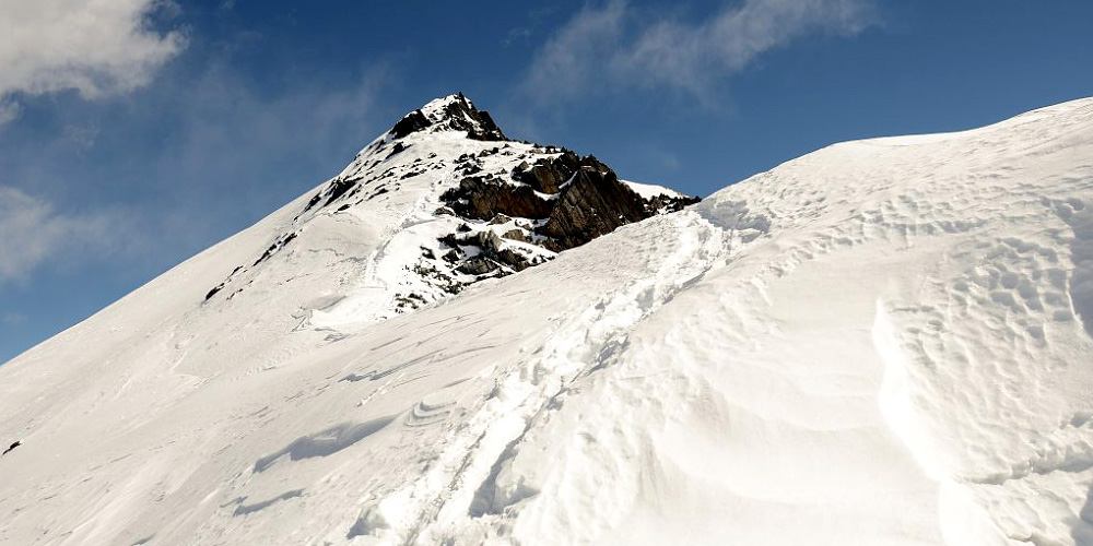
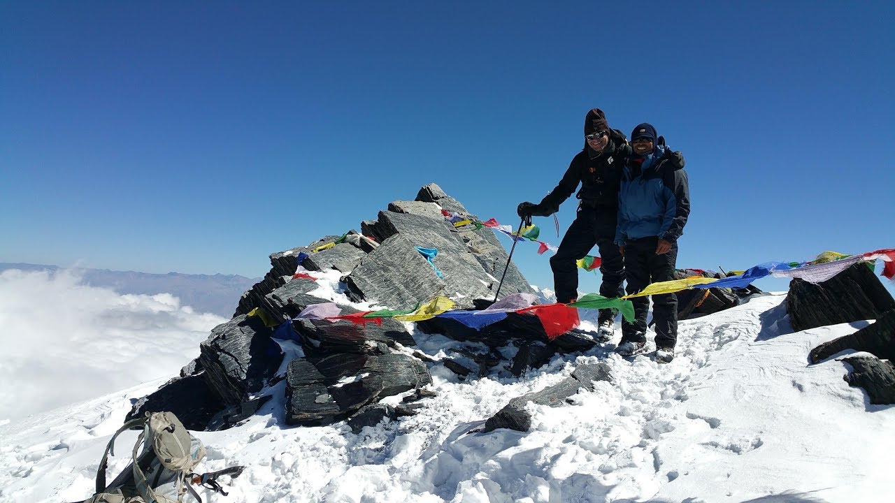
Day 16: Trek> Thapa Peak (6012 m), Base of Thapa Peak (4900 m)
Day 17: Trek> Yak Karka (4200 m)
Day 18: Trek> Marfa (2700 m)
Day 19:flight> Pokhara (800m)
Day 20: Pokhara, flight > Kathmandu (1320 m)
Day 21: Kathmandu
Day 22: departure
3 Hours Before Flight Time
Flight on a scheduled airline, Qatar, Gulf Air, Jet Airways … Even if the connections are not always perfect, they are the only ones to offer good services to reach Kathmandu.
Customs formalities, baggage claim and welcome by the local guide. Transfer to Hotel Yak & Yeti (5 * hotel located in downtown). According to arrival time, first exploring the city (or Durbar Square Pashupatinath). Accommodation: Hotel
Early start on the first flight to Pokhara. Transfer by private bus, adapted to the size of the group, to Beni, a small town situated at the foot of Annapurna. Beautiful landscapes of rice paddies and traditional villages of Nepal. Latest miles on a track. Installation at the lodge in the center of Beni. Transfer: 4
Accommodation: Lodge
Depart Myagdi Khola valley through authentic villages and terraced fields. The heat is omnipresent; lovers umbrella umbrella can be used to bring … Some suspension bridges in the village of Tatopani. Lunch near the hot springs for a last swim Darbang … Continue to the charming village which combines some shops, among the last of this itinerary. Accommodation: Lodge
Elevation: 230 m
Elevation: -130 m
A second day promises to be hot! The Myagdi khola moving north to quickly shrink at Phedi … A steep climb through the pine achieves Dharapani, very authentic village where people still working the harvests by hand! Camp in the village. Accommodation: Camp
Elevation: 750 m
Elevation: -250 m
Departure to a cooler climate! The view of the surrounding mountains is already very pleasant with Gurjit Himal (7190 m) and Daulaghiri IV (7661 m) in focus. Through colorful terraces, the trail starts on the balcony to reach the village of Mudi, village character has preserved traditional architecture Magar. Accommodation: Camp
Elevation: 750 m
Elevation: 500m
The itinerary begins with a descent to Yugapani. From there a steep climb steep trail allows the open on the summits of the high chain of Daulaghiri, before sinking back into a canyon surrounded by huge waterfalls. The last village before the French Pass is Boghar sparse village with approximately 280 inhabitants. Overnight in the school yard, it will be an opportunity to provide notebooks and pens or other balls for these students away from it all! Accommodation: Camp
Elevation: 1200 m
Elevation: -850 m
By a succession of climbs and descents, the trail passes through thick forest where a few huts remain isolated containing the last buffalo breeders. Fair cacades nearby. Overnight in the summits of Daulaghiri. Accommodation: Camp
Elevation: 900 m
Elevation: -400 m
Sunrise on the beautiful Daulaghiri IV. The trail descends steep and sometimes slippery Konaban to the river to reach the small bridge to reach the other side … A second bridge, not properly maintained, then across the Myagdi khola … The subtropical vegetation gradually disappears, giving way a forest clearer and drier pine dominated Himalayan. Camp at the heart of the beautiful pines in a dry environment compared to other camps .. Accommodation: Camp
Elevation: 900 m
Elevation: -300 m
The forest disappears, and quickly gives way to the world of high mountains. Passage at the foot of the icefall Manapati. Moraines and ice took place around the trail. Camp in an area comfortable and pleasant tree line. Accommodation: Camp
Elevation: 700 m
Elevation: -200 m
Day of rest or ride on the heights of camp. The guide is here to help you in the choices (resting or walking) … Accommodation: Camp
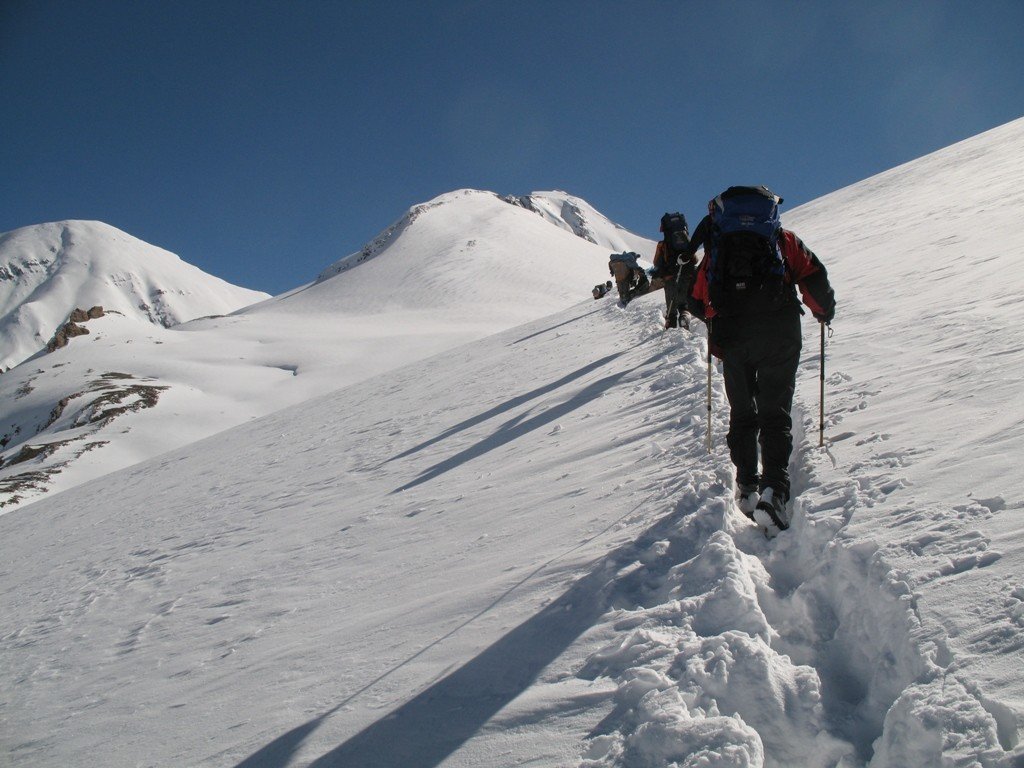
For an ice tongue, the path joins the old bed of the glacier Chhonbardan become a long and rocky gorge gradually widening the Sita Chu at 6600 m. Needed to clear a camp 4300 m. Accommodation: Camp
Elevation: 600 m
Elevation: -50 m
The glacier becomes permanent, the pyramid is omnipresent Daulaghiri to crush us with its gigantic … In a few hours to completely change the environment, more likely, now is the cold and ice dominated … Accommodation: camp
Elevation: 350 m
Elevation: -20 m
Rest or walk around the neighborhood … Accommodation: Camp
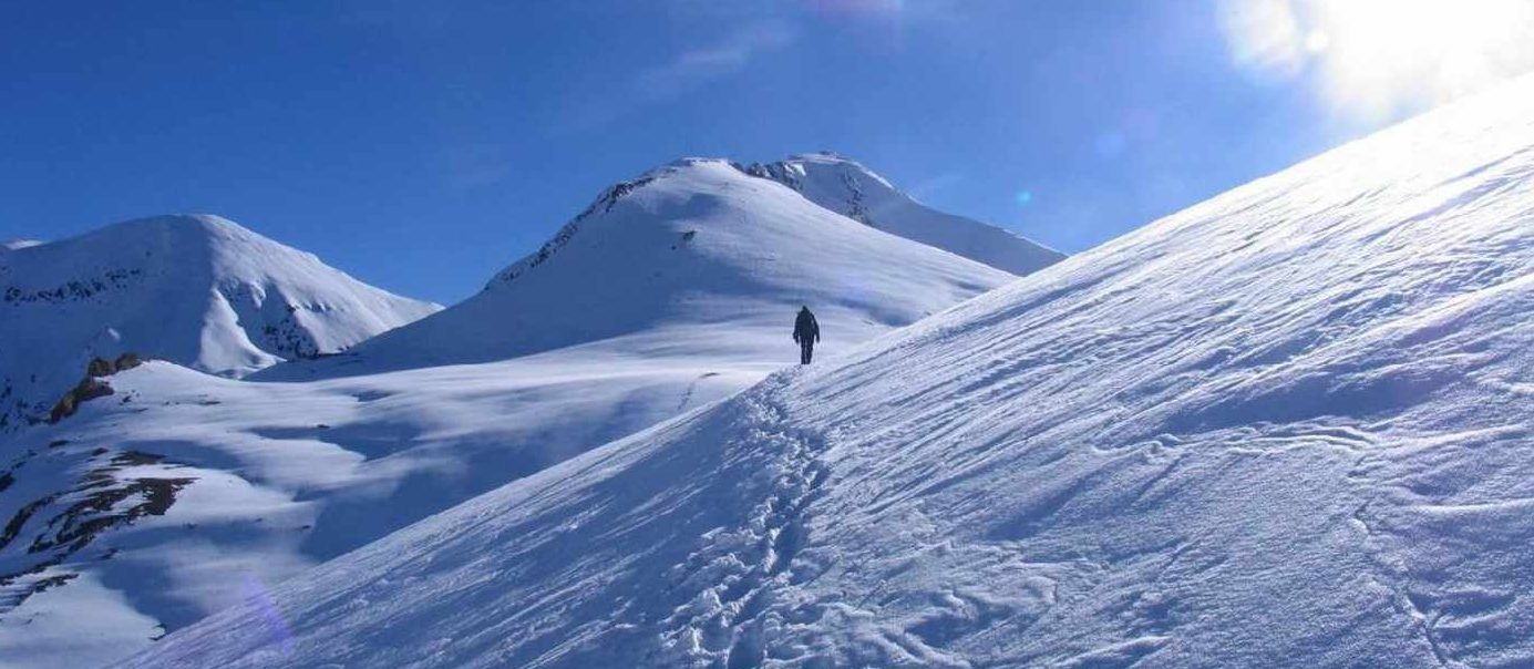
The trail rises quickly after leaving the glacier to reach a peak by the French Pass at 5360 m Slopes gently to the camp of Tukuche Peak. View of the surrounding peaks. Accommodation: Camp
Elevation: 870 m
Elevation: -370 m
A short climb Thapa joined the Pass at 5,250 m with views of the Nilgiris and the chain of Annapurna. From the pass, the path climbs through large boulders, without technical difficulties, to reach 6000 meters. Viewed exceptional 360 °. Long descent to camp. Accommodation: Camp
Elevation: 1000 m
Elevation: -2100 m
Long crossing over to join the Yamkim Khola green pasture and Yak Karka. Last night’s camp at altitude Annapurna and Nilgiri face. Accommodation: Camp
Elevation: 200 m
Elevation: -900 m
The trail continues from first side to quickly dive to the Kali Gandaki. The atmosphere is beautiful above the town of Marfa. Check the beautiful village where takhali local cider and calvados ahead. Night at the Lodge. Accommodation: Lodge
Elevation: 50 m
Elevation: -1550 m
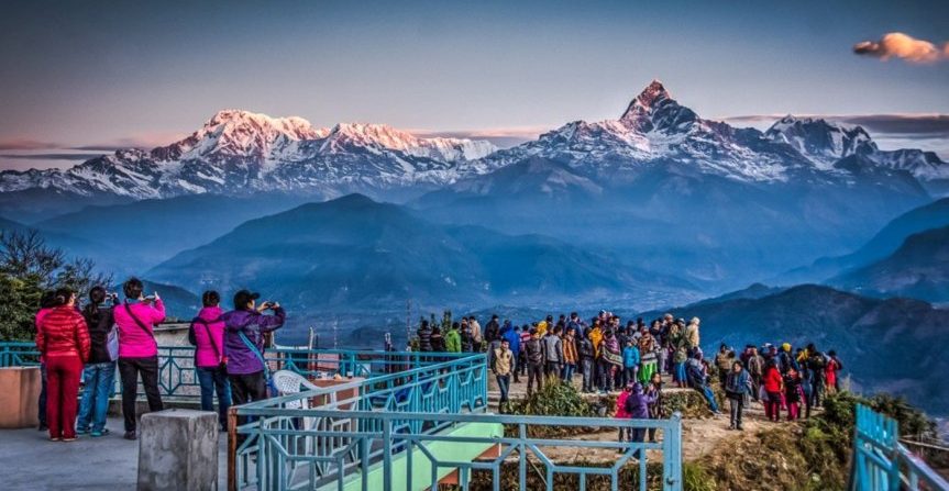
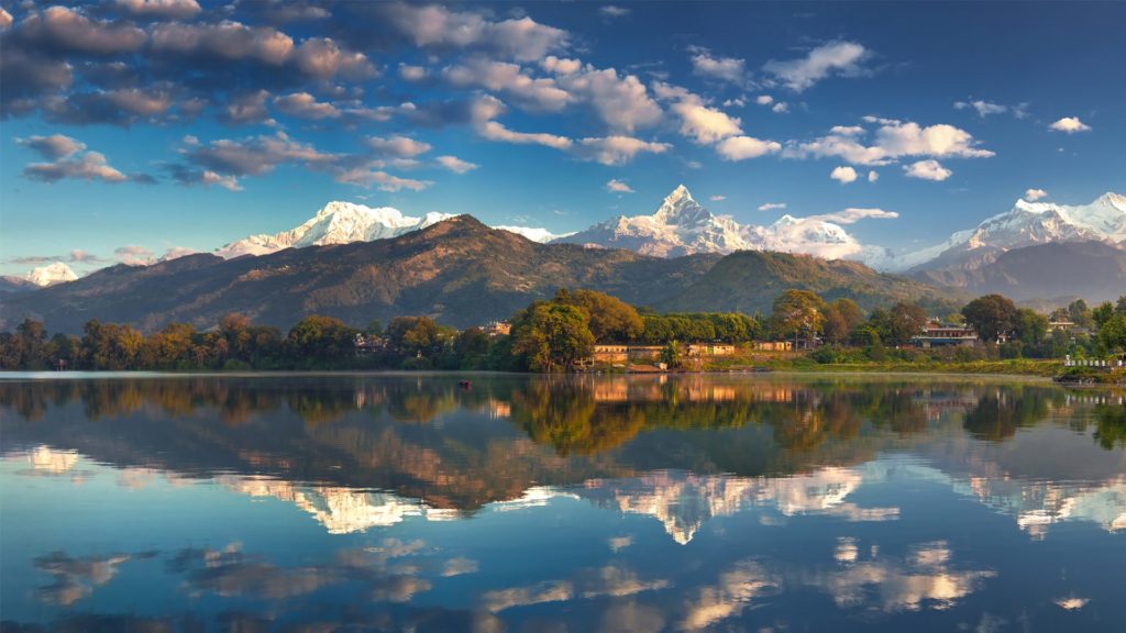
Morning departure by jeep through the new track that joins Jomosom. Morning flight to Pokhara. This flight, beautiful clear day, passes over the deepest valley in the world and is obviously dependent on the weather! Transfer to HOTEL IN Pokhara, free time, stroll through the bazaar or on the lake before a well deserved night at the hotel. Accommodation: Hotel
Free morning in Pokhara, lunch and afternoon flight to Kathmandu. Transfer: 0:20
Accommodation: Hotel
Day tour of the valley. To determine the guide. Accommodation: Hotel
Free day and evening flight bound. Attention, 20-22 days are days of flapping in case of cancellation of flight day 18. Accommodation: Hotel
Because domestic flights subject to weather hazards, and the weather during the trekking route and may be modified at any time! You need to instead trust the coach who will make the right decisions in connection with the team. No request will be accepted at modified security-related!
For security reasons (weather or other) and in the interest of participants, the guide reserves the right to change the route described above.